Drone, Lidar Mapping and GIS Solutions
Unbar the potential of the open sky with the best Drone services.
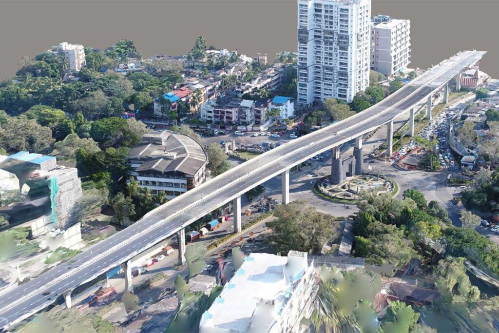
Specialized Drone services for projects across India, including Aerial Photography, … drone services, drone surveying, inspection, UAV data processing, Orthophotoprocessing.
- 10X Faster Data Acquisition
Our qualified drone pilots and high-end UAV surveying and inspection allow us to procure data 10x faster than other traditional methods.
-
99.9% Accurate Survey
We use machine learning, comprehensive UAV surveying, and mapping to produce up to 99% accurate volumetric measurements and yield estimation.
Our Services:
- Aerial Photography
- Orthophoto Processing
- Aerial Inspection & Analysis
- UAV Data Processing
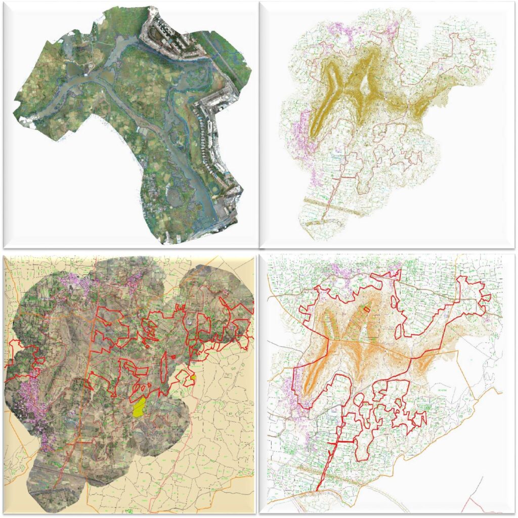
- Orthomosaic Digitization
- Contour generated & Physical
- Village Plan superimposed to Orthomosaic
- Contour Generated & Superimposed to village plan.
Deliverables of Drone Survey:
How can we help you?
To order a survey or find out more about how we can assist you with your next project, please contact us.
Mumbai Metropolitan Region Development Authority
S.P Surveyors has executed the said work satisfactorily within the scheduled requirements.
Aerial data through drone surveys is proficient & accurate. Now you can make mindful decisions cost-effectively.
CONTACT
Dombivli Office
Call: +91 9221683888
Email: Gopi@spsurveyors.com
Level 0, Ashirvad Exotica Apartment, Rajaji Path, Dombivli (E) 421201, India
Mulund Office
B-202, Trivedi Tower, J.N Road, Nr Mulund ST, Above Indian Bank, Mumbai-80
Monday – Friday: 10:00am – 6:00pm
MENU
> Home
> About Us
> Our Services
> Our Projects
> Blog
> Contact Us
© 2021 SP SURVEYORS | Developed by Quick Time Production